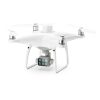
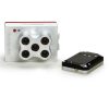
Slantrange 4P Multispectral Sensor
Aerial systems can reveal crop conditions that aren’t measurable by other means – conditions that can drive critical decisions and new forecasting methods. The Slantrange 4P Multispectral Sensor Series are built upon years of validation in the demanding field of aerial phenotyping for leading agricultural suppliers for accurate and specific data delivery.
Slantview is the program developed to convert your data into usable maps, click here to learn more.
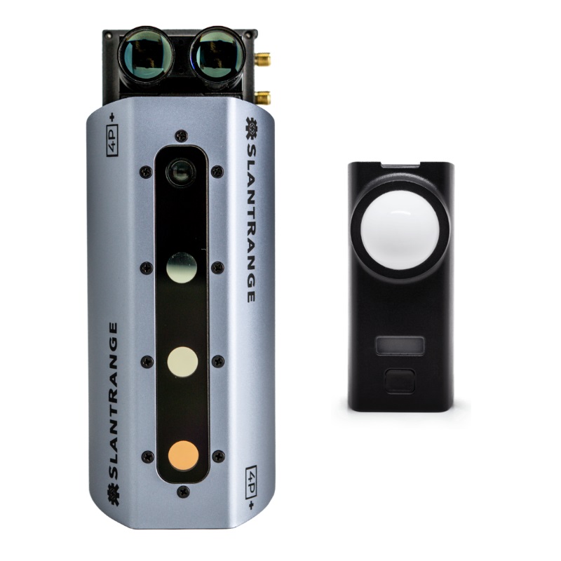
Slantrange 4P and Slantrange 4P+

Accuracy is essential. Prescriptive input decisions and forecasts rely on accurate measurements that aren’t subject to change from day-to-day or hour-to-hour with changing sunlight conditions.
Slantrange pioneered and patented the industry’s first on-board sunlight correction capability with our Ambient Illumination Sensors (AIS) – and every sensor generation has included it as a standard feature. The result is data you can trust over a wide range of illumination conditions, without the need for cumbersome “calibration panels” on the ground. (US Patents 9,470,579 and 9,791,316; Australia Patent 2015315327 B2 )
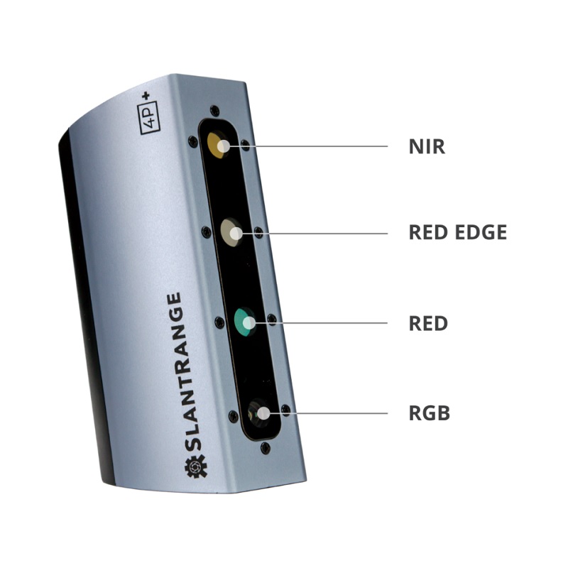
SLANTRANGE 4P Multispectral sensors mounted on a drone, simultaneously measures sunlight and the crop signature in narrow bands of the spectrum that are critical to quantifying plant health – so crop health can be tracked over time. Sound Complicated? Read on as we explain how these sensors work to provide you with valuable information to increase your crop health and as a result, income.
Need Higher Levels of Accuracy?
For many growers, an accurate measure of yield prior to harvest can be transformative in reducing logistics and distribution costs.
For input suppliers, plant morphology can reveal how new developmental products are performing in real world conditions.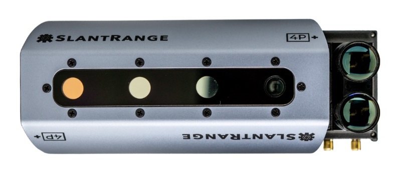 To measure plant or fruit size, accurate knowledge of the sensor distance is essential – and something that even RTK GPS won’t deliver alone. In an industry first, we’ve incorporated a precision navigation solution through a simple modular add-on to our 4P Series sensors to solve one of the most vexing problems in agricultural aerial imaging.
Food Security
Our goal is to produce more with less. More food with less land, less water, fewer chemicals, less waste. Virtually every production industry in today’s world employs some level of process control to achieve the same goal – more with less. But agriculture, from planting to harvest, has a difficult problem. The only tools of measurement are the sparse and subjective eyes of agronomists and scouts.
The Slantrange 4P multispectral sensor changes that. We’re providing agriculture a new means of process control from planting to harvest. Our technology derives important crop health metrics from the same physical process that plants use to power their own growth – their interaction with sunlight.
To work for agriculture, we’ve made our technology scalable over large areas and into regions with limited or zero network accessibility. We’ve also developed new technologies around the collection, processing, and dissemination of our agricultural intelligence to meet the immediacy and workflow needs of our customers. So they can get on with the business of producing more with less.
Skyport Integration
In-Flight Data with DJI SKYPORT, introduced with our 3PX sensor in 2018, the new 4P Series sensors include DJI SKYPORT integration as an optional add-on. Ensure the quality of your data collections with in-flight data accessibility via DJI’s Payload SDK.
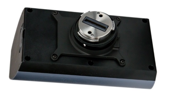
Integration kits are available for other drones, contact us for more information about integrating your drone.
Vital Information for Agriculture
SLANTRANGE’s measurement systems are quantifying crop development in ways never before possible with satellite or manned aircraft systems. With spatial resolutions down to a couple of centimetres, we can now rapidly isolate every plant in a field for analysis – and that enables some truly unique capabilities:
- Crop population statistics – Plant density and size information to support decisions for replanting and baselines for insurance.
- Weed population statistics – Detect individual weeds down to a few centimeters for targeted herbicide applications.
- Stress conditions – Pest infestations, nutrient deficiencies, and dehydration are detected and zoned for treatment.
- Canopy closure – Quantify the percentage of a field with a closed canopy to support yield estimations and substantiate crop damage insurance claims.
- Yield potential – An intelligent combination of several other metrics to estimate potential yield at harvest.
What Is Spectral Imaging?
Even if the term is new to you, you are familiar with spectral imaging. It’s a technique that exploits light reflectivity from an object to infer new information about the nature of that object. More simply put, we can learn things about an object from its colour. In fact we’re all familiar with spectral imaging when it comes to vegetation – we know that as autumn arrives the green hues of summer give way to oranges and reds.
But have you considered why those colours change? As a plant’s health and maturity evolve throughout the season, its chemistry and cellular structure evolve as well. Those changes are evident in the sunlight it absorbs, transmits, or reflects. In fact a leaf’s colour is telling you about what’s happening with its biological processes. In a plant’s most vigorous stages of growth and maturity, chlorophyll and other accessory pigments soak up the blue and red portions of the sunlight that strikes its leaves and reject the green portion. That’s why healthy looking plants are deep green in colour. Photosynthetic activity decreases and more of the red portion of the spectrum is reflected when plants senesce.
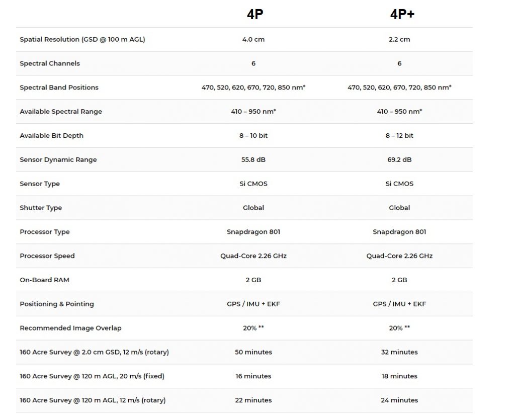
| Select your Sensor | Slantrange 4P, Slantrange 4P+ |
|---|

