DJI Terra Pro Software
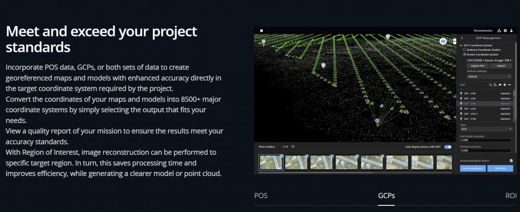
DJI Terra Pro Software Subscription for 12 months allows you to create efficient flight paths using predefined waypoint actions and adjustable parameters like altitude, speed, gimbal pitch angle, aircraft heading and more. For more complex and tight missions that require high attention to detail, use 3D Flight Visualization to design and simulate tasks on existing 3D models.
3D Models
Get sharp and realistic representations of your surroundings throughout various industrial applications, be it accident reconstruction, recreating thin power lines and complex vertical structures, managing major construction projects and more. The CUDA-based reconstruction algorithms are capable of quickly processing large amounts of data to deliver quality results.
2D Maps
Generate high resolution orthomosaics, enabling you to get detailed and accurate measurement results for all your critical projects.
LiDAR
Process point cloud data captured by the Zenmuse L1 in DJI Terra. In just one click, calculate POS data, fuse point cloud and visible light data, export point clouds in standardized formats, and generate fieldwork reports.
Multispectral
Using multispectral data from P4 Multispectral, generate radiometrically calibrated reflectance maps for remote sensing research and more, or produce vegetation index maps including NDVI and NDRE. Create prescription maps for variable rate application using DJI’s Agras drones to improve crop yields while driving down costs.
Real-time 3D Mapping
Easy Data Analysis
In addition to map and model creation, DJI Terra helps users analyze data and generate instant insights with easy-to-use analysis tools that provide a variety of measurements including linear distance, surface area and volumetric estimations. To improve team communication and reporting throughout ongoing projects, annotation labels can be edited and shared. For detailed site inspections and accident reconstruction situations, DJI Terra’s photo inspection tool lets users closely examine every photo used to create the model so they can pinpoint and highlight critical elements.
See the Agras T30 Spraying Drone here